|
SECCHI Time-Elongation Plots
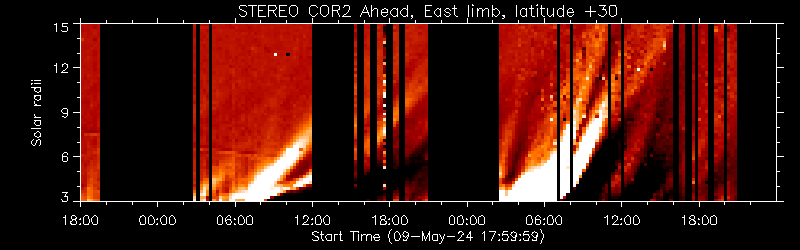
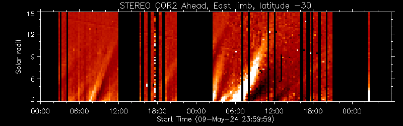
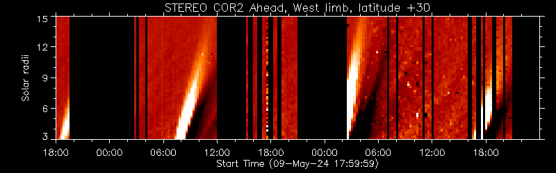
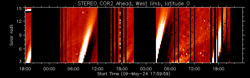
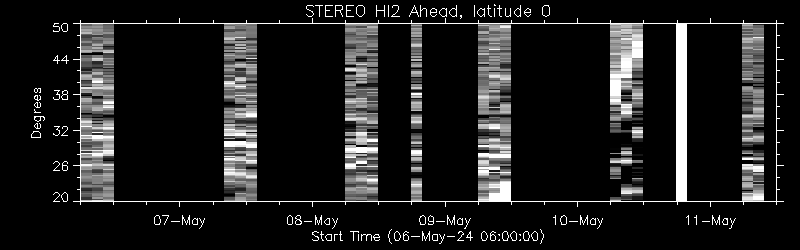
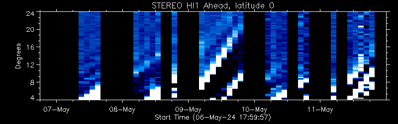
Below are time-elongation plots built up from SECCHI running difference
images, known colloquially by some as "J-plots". Coronal mass ejections
(CMEs) are seen as diagonal bright and dark bands running from lower-left to
upper-right. The steepness of the band reflects the speed of the CME.
Occasionally one can also see planets or bright stars as streaks in the
plots.
These plots are built up from the SECCHI beacon images. The STEREO space
weather beacon telemetry mode is a very low rate, highly compressed data stream
broadcast by the spacecraft 24 hours per day. These data are used for space
weather forecasting. Because of the large compression factors used, these
beacon images are of much lower quality than the actual science data.
| Realtime resources: |
|
Browse resources: |
|
|
|
|
COR2 Ahead, East limb

Plots revised: Saturday, 02-May-2026 11:40:03 UTC
COR2 Ahead, West limb
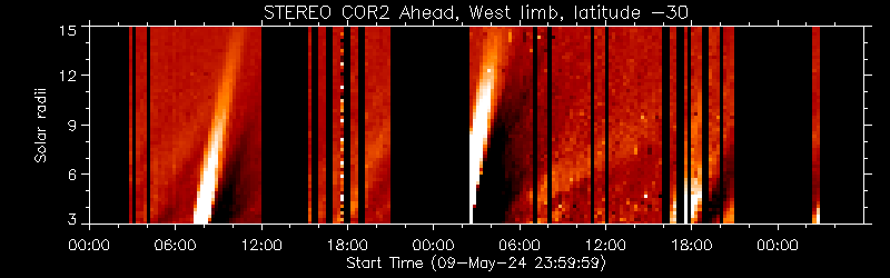
Plots revised: Saturday, 02-May-2026 11:40:03 UTC
HI Ahead, West limb
Plot revised: Saturday, 02-May-2026 10:13:36 UTC
Plot revised: Saturday, 02-May-2026 11:35:35 UTC
This page should automatically update every 5 minutes. Otherwise, use your
browser's "reload" button to get the most recent plot.
The data on this page include telemetry collected by the following
organizations:
- NASA Deep Space Network
- Amateur station DL0SHF, Kiel-Ronne, Germany
- AMSAT-DL/Bochum Observatory, Germany
- Johns Hopkins University Applied Physics Laboratory, Laurel, MD, USA
We would also like to acknowledge the past assistance from the following
organizations:
- Rutherford Appleton Laboratory: Chilbolton, UK
- Centre National d'Etudes Spatiales: Toulouse, France
- Korean Space Weather Center: Jeju, South Korea
- National Institute of Information and Communications Technology: Koganei, Japan
In addition, we wish to acknowledge
- Amateur station KA9Q, Phil Karn, for writing and donating the decoding
software used at the ground stations.
- NOAA Space Weather Prediction Center for organizing and scheduling the
ground station network.
Last Revised: Monday, 28-Oct-2024 18:36:30 UTC
Responsible NASA Official: ![[email address: Therese.A.Kucera<at>nasa<dot>gov]](/img/kucera_email1.jpg)
Accessibility
Privacy Policy and Important Notices
Feedback and comments: webmaster
|